![]()
Users do not have to be a photogrammetist to use this step by step stand- alone package.
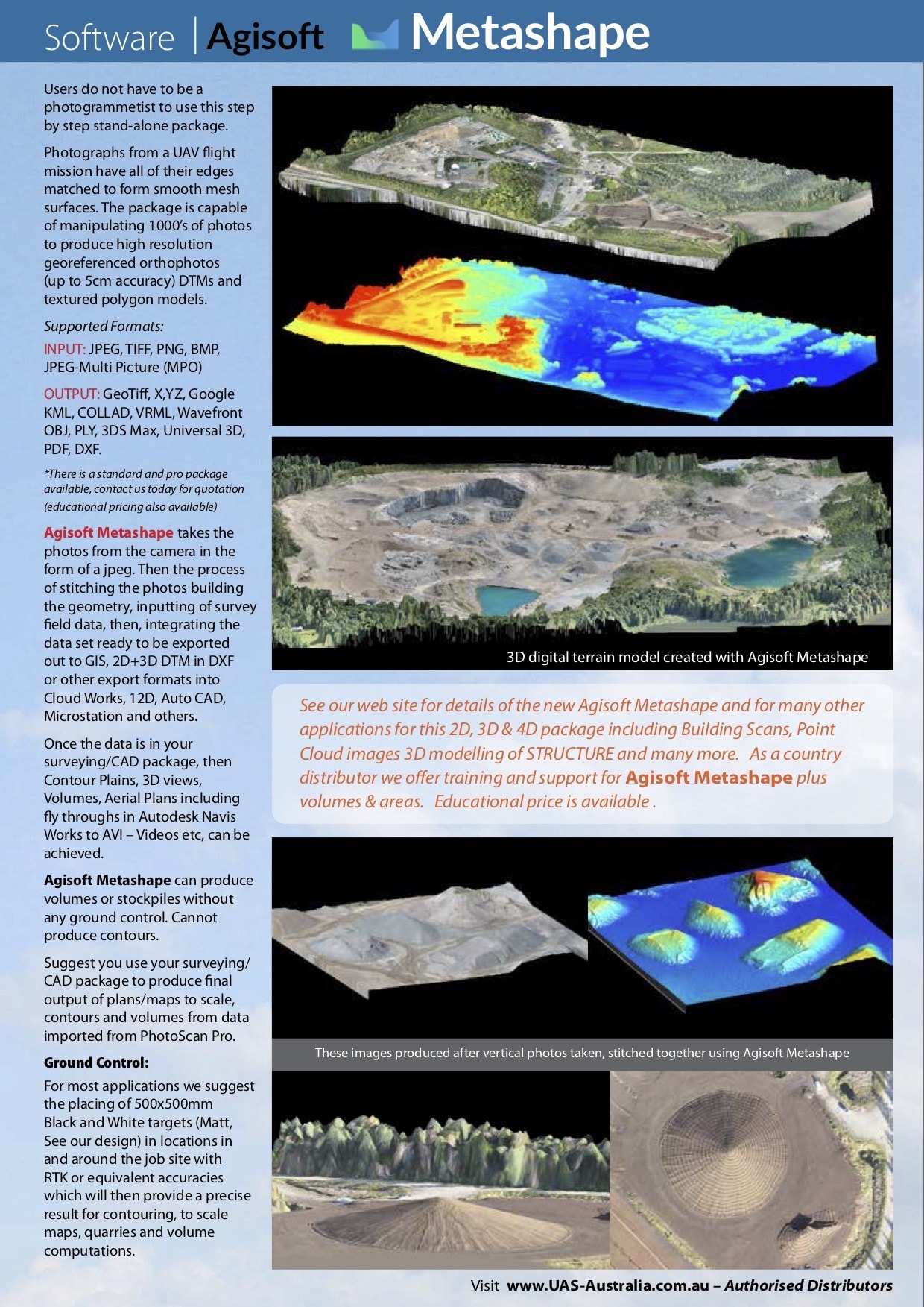
Photographs from a UAV flight mission have all of their edges matched to form smooth mesh surfaces. The package is capable of manipulating 1000’s of photos to produce high resolution georeferenced orthophotos (up to 5cm accuracy) DTMs and textured polygon models.
Intelligent photogrammetry
Agisoft Metashape is a cutting edge software solution, with its engine core driving photogrammetry to its ultimate limits, while the whole system is designed to deliver industry specific results relying on machine learning techniques for post-processing and analysis tasks.
Supported Formats:
INPUT: JPEG, TIFF, PNG, BMP, JPEG-Multi Picture (MPO)
OUTPUT: GeoTiff, X,YZ, Google KML, COLLAD, VRML, Wavefront OBJ, PLY, 3DS Max, Universal 3D, PDF, DXF.
*There is a standard and pro package available, Contact Us today for quotation (educational pricing also available)
Agisoft Metashape takes the photos from the camera in the form of a jpeg. Then the process of stitching the photos building the geometry, inputting of survey field data, then, integrating the data set ready to be exported out to GIS, 2D+3D DTM in DXF or other export formats into Cloud Works, 12D, Auto CAD, Microstation and others.
Once the data is in your surveying/CAD package, then Contour Plains, 3D views, Volumes, Aerial Plans including fly throughs in Autodesk Navis Works to AVI – Videos etc, can be achieved.
Agisoft Metashape can produce volumes or stockpiles without any ground control. Cannot produce contours.
Suggest you use your surveying/CAD package to produce final output of plans/maps to scale, contours and volumes from data imported from PhotoScan Pro.
Ground Control:
For most applications we suggest the placing of 500x500mm Black and White targets (Matt, See our design) in locations in and around the job site with RTK or equivalent accuracies which will then provide a precise result for contouring, to scale maps, quarries and volume computations.